
फाइल:England locator map with North East England highlighted.svg

पूर्वावलोकन PNG क आकार SVG फाइल: ४९४ × ६०० चित्राणु दोसर resolutions: १९८ × २४० चित्राणु | ३९५ × ४८० चित्राणु | ६३२ × ७६८ चित्राणु | ८४३ × १,०२४ चित्राणु | १,६८६ × २,०४८ चित्राणु | ८१६ × ९९१ चित्राणु।
पूर्ण आनन्तर्य (एसभिजी फाइल, मामूली रूपमे ८१६ × ९९१ चित्रकण, फाइलक आकार: ४६९ KB)
| ई फाइल विकिमिडिया कमन्ससँ अछि। कमन्सकs विवरण पृष्ठसँ जानकारी एतए नीचाँ देखाएल गेल अछि। कमन्स एक फ्रि लाइसेन्स मिडिया फाइल परियोजना छि। अपने मद्ददतकs सकए छि। |
| जानकारी |
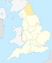
English: Equirectangular projection of England; North East England is highlighted. |
| दिनाङ्क | |
| स्रोत | File:England location map.svg |
| लेखक | |
| अनुमति (ई फाइलक पुनः उपयोग) |
ई फाइल लाइसेन्सड अछि एहि अन्तर्गत क्रिएटिभ कमन्स एट्रिब्युसन-सेयर अलाइक ३.० अनपोर्टेड लाईसेन्स ।
|
फाइल इतिहास
तखनका तिथि/ समए पर क्लिक करी जखनका फाइल देखबाक अछि
| तिथि/ समए | लघुचित्र | बीमसभ | प्रयोक्ता | समीक्षा | |
|---|---|---|---|---|---|
| अखनका | १५:१९, ८ अप्रैल २०१० | | ८१६ × ९९१ (४६९ KB) | Jappalang | {{Information |Description=Equirectangular projection of England; Northumberland is highlighted |Source=File:England location map.svg |Date=2010-04-08 |Author=* File:England location map.svg: Spischot * author: [[User:Jappalang |
फाइलक उपयोग
ई 2 पन्नासभमे ई फाइलक लिङ्क अछि:
विश्वव्यापी फाइल उपयोग
ई फाइल कऽ उपयोग निम्न दोसर विकिसभमे अछि:
- am.wikipedia.org कऽ उपयोग पर
- ar.wikipedia.org कऽ उपयोग पर
- as.wikipedia.org कऽ उपयोग पर
- bh.wikipedia.org कऽ उपयोग पर
- blk.wikipedia.org कऽ उपयोग पर
- bn.wikipedia.org कऽ उपयोग पर
- bs.wikipedia.org कऽ उपयोग पर
- ca.wikipedia.org कऽ उपयोग पर
- cy.wikipedia.org कऽ उपयोग पर
- da.wikipedia.org कऽ उपयोग पर
- diq.wikipedia.org कऽ उपयोग पर
- dty.wikipedia.org कऽ उपयोग पर
- dv.wikipedia.org कऽ उपयोग पर
- en.wikipedia.org कऽ उपयोग पर
- Template:Location map+
- Template:Location map~
- Template:Location map+/doc
- Template:Location map+/sandbox
- Template:Location map+/testcases
- Template:Location map~/sandbox
- Template:Location map+/AlternativeMap
- User:Arjunaraoc/sandbox/SampleMap1
- User:Arjunaraoc/sandbox/SampleMap2
- User:Arjunaraoc/sandbox/SampleMap3
- en.wikibooks.org कऽ उपयोग पर
- en.wikiversity.org कऽ उपयोग पर
- fa.wikipedia.org कऽ उपयोग पर
ई फाइलक विश्वव्यापी उपयोगक अधिक जानकारी देखी।