
फाइल:Haryana locator map.svg

पूर्वावलोकन PNG क आकार SVG फाइल: ४८१ × ५९९ चित्राणु दोसर resolutions: १९३ × २४० चित्राणु | ३८५ × ४८० चित्राणु | ६१७ × ७६८ चित्राणु | ८२२ × १,०२४ चित्राणु | १,६४५ × २,०४८ चित्राणु | ९५४ × १,१८८ चित्राणु।
पूर्ण आनन्तर्य (एसभिजी फाइल, मामूली रूपमे ९५४ × १,१८८ चित्रकण, फाइलक आकार: ८३ KB)
| ई फाइल विकिमिडिया कमन्ससँ अछि। कमन्सकs विवरण पृष्ठसँ जानकारी एतए नीचाँ देखाएल गेल अछि। कमन्स एक फ्रि लाइसेन्स मिडिया फाइल परियोजना छि। अपने मद्ददतकs सकए छि। |
| शीर्षक |
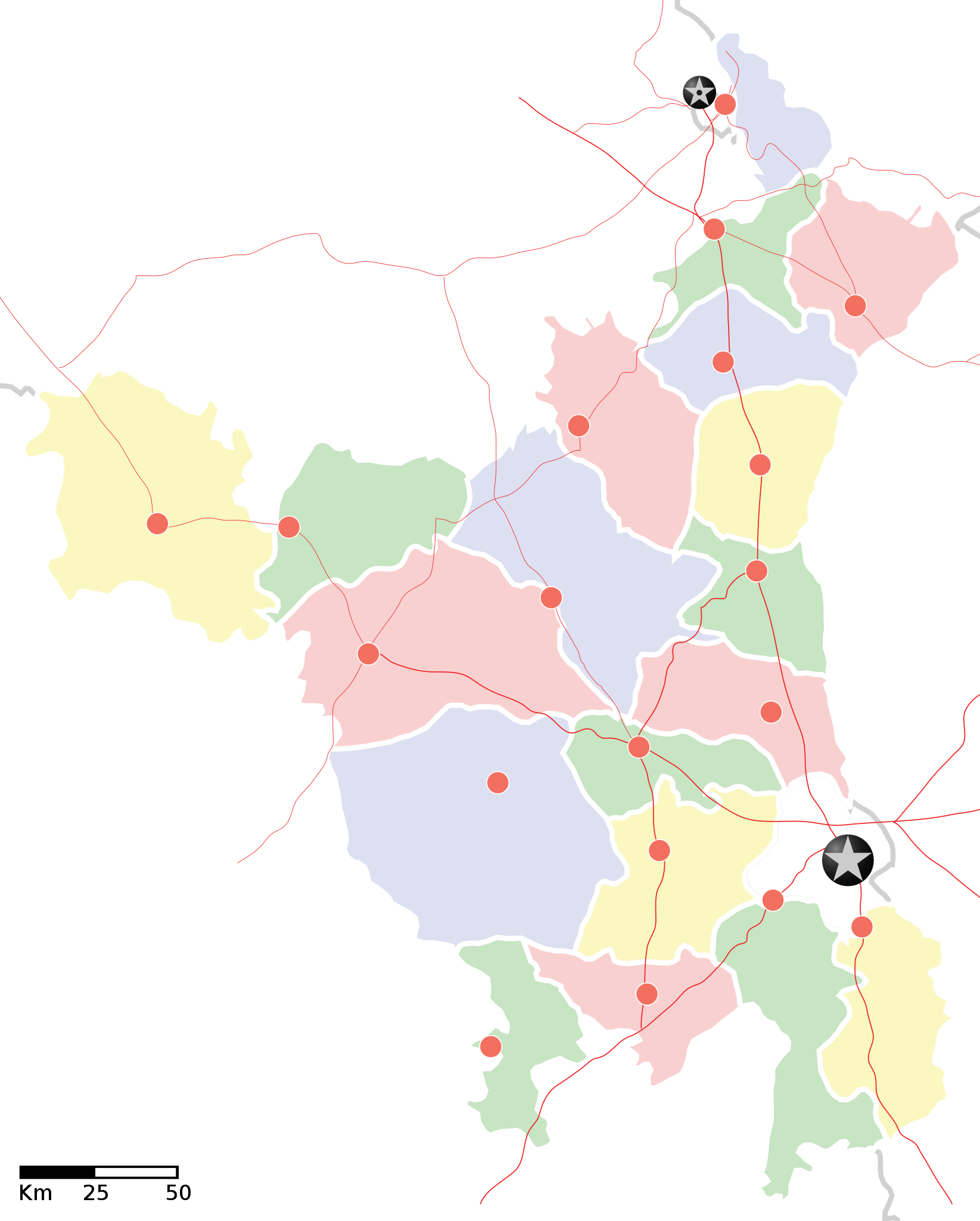
Haryana locator map |
||
| Description |
Locator map of the state of en:Haryana, India with district boundaries. Equirectangular projection. Geographic limits of the map: top=30.975 |
||
| दिनाङ्क | |||
| स्रोत |
अपन काम |
||
| रचियता |
|
||
| अनुमति (ई फाइलक पुनः उपयोग) |
मैं, इस कार्य का/की कॉपीराइट धारक, इसे निम्न लाइसेंस के अंतर्गत प्रकाशित करता/करती हूँ: ई फाइल लाइसेन्सड अछि एहि अन्तर्गत क्रिएटिभ कमन्स एट्रिब्युसन-सेयर अलाइक ३.० अनपोर्टेड लाईसेन्स ।
|
||
| Geotemporal data | |||
| Date depicted | second half of 20 century आर 21 century | ||
| Georeferencing | If inappropriate please set warp_status = skip to hide. | ||
| Archival data | |||
| नोट्स | Part of WikiProject India Maps | ||
![[1]](http://maps.newkerala.com/Haryana-Travel-Map.jpg)
फाइल इतिहास
तखनका तिथि/ समए पर क्लिक करी जखनका फाइल देखबाक अछि
| तिथि/ समए | लघुचित्र | बीमसभ | प्रयोक्ता | समीक्षा | |
|---|---|---|---|---|---|
| अखनका | २३:२०, ९ सितम्बर २००८ | | ९५४ × १,१८८ (८३ KB) | Planemad | {{Information |Description= |Source= |Date= |Author= |Permission= |other_versions= }} |
| २३:१६, ९ सितम्बर २००८ |  | ९५४ × १,१८८ (८३ KB) | Planemad | {{Information |Description={{en|1=a}} |Source=Own work by uploader |Author=PlaneMad |Date= |Permission= |other_versions= }} <!--{{ImageUpload|full}}--> |
फाइलक उपयोग
ई 2 पन्नासभमे ई फाइलक लिङ्क अछि:
विश्वव्यापी फाइल उपयोग
ई फाइल कऽ उपयोग निम्न दोसर विकिसभमे अछि:
- ar.wikipedia.org कऽ उपयोग पर
- as.wikipedia.org कऽ उपयोग पर
- awa.wikipedia.org कऽ उपयोग पर
- खाँचा:हरियाणा
- अम्बाला जिला
- करनाल जिला
- कर्ण झील
- कालका
- कुरुक्षेत्र जिला
- कैथल जिला
- गुड़गांव जिला
- गुरुग्राम
- चरखी दादरी
- तेलंगाना कय जिला
- पंचकुला
- पंचकूला
- पानीपत ज़िला
- पानीपत जिला
- पेहवा
- फरीदाबाद
- बड़खल झील
- मोरनी हिल्स
- रोहतक
- लोकसभा चुनाव क्षेत्रन कय सूची
- सोनीपत जिला
- हरियाणा विधानसभा
- हिसार
- खाँचा:तेलंगाना कय जिला
- खाँचा:हरियाणा कय लोकसभा चुनाव क्षेत्र
- खाँचा:हरियाणा कय विधानसभा चुनाव क्षेत्र
- ba.wikipedia.org कऽ उपयोग पर
- bo.wikipedia.org कऽ उपयोग पर
- ceb.wikipedia.org कऽ उपयोग पर
- ckb.wikipedia.org कऽ उपयोग पर
- de.wikipedia.org कऽ उपयोग पर
- en.wikipedia.org कऽ उपयोग पर
- es.wikipedia.org कऽ उपयोग पर
- fa.wikipedia.org कऽ उपयोग पर
- fi.wikipedia.org कऽ उपयोग पर
- gu.wikipedia.org कऽ उपयोग पर
ई फाइलक विश्वव्यापी उपयोगक अधिक जानकारी देखी।