
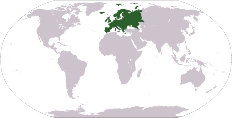
फाइल:LocationEurope.png

ऐ पूर्वदृश्यक आकार: ८०० × ४०७ चित्राणु. दोसर resolutions: ३२० × १६३ चित्राणु | ६४० × ३२६ चित्राणु | १,०२४ × ५२१ चित्राणु | १,२८० × ६५१ चित्राणु | २,७५९ × १,४०४ चित्राणु।
पूर्ण आनन्तर्य (२,७५९ × १,४०४ चित्राणु, फाइल आकार: ९९ KB, माइम प्रकार: image/png)
| ई फाइल विकिमिडिया कमन्ससँ अछि। कमन्सकs विवरण पृष्ठसँ जानकारी एतए नीचाँ देखाएल गेल अछि। कमन्स एक फ्रि लाइसेन्स मिडिया फाइल परियोजना छि। अपने मद्ददतकs सकए छि। |

|
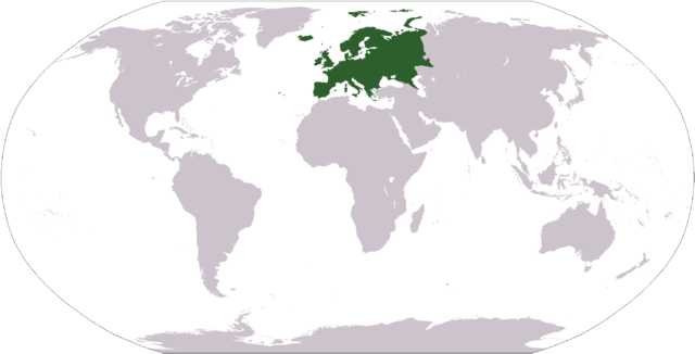
File:LocationEuropeGreen.svg is a vector version of this file. It should be used in place of this PNG file when not inferior.
File:LocationEurope.png → File:LocationEuropeGreen.svg
For more information, see Help:SVG. |
 |
| जानकारी |
Deutsch: Weltkarte mit Fokus auf Europa.
English: World map depicting Europe.
Esperanto: Mondmapo bildiganta Eŭropon.
Español: Ubicación de Europa.
Українська: Карта світу, на якій виділена Європа.
Bahasa Indonesia: Peta dunia yang menyoroti Eropa. |
| दिनाङ्क | |
| स्रोत | own work - map adapted from PDF world map at CIA World Fact Book |
| लेखक | user:Cumhur |
| दूसरे संस्करण |
Derivative works of this file: Wikinews Europa mapa.png - |
This image is in the public domain because it contains materials that originally came from the United States Central Intelligence Agency's World Factbook.
|
 |
फाइल इतिहास
तखनका तिथि/ समए पर क्लिक करी जखनका फाइल देखबाक अछि
| तिथि/ समए | लघुचित्र | बीमसभ | प्रयोक्ता | समीक्षा | |
|---|---|---|---|---|---|
| अखनका | १७:२७, २८ सितम्बर २००८ | | २,७५९ × १,४०४ (९९ KB) | Aaker | Reverted to version as of 12:40, 19 January 2008 |
| ०१:१४, २८ सितम्बर २००८ |  | २,७५९ × १,४०४ (८५ KB) | Octane | eurosocialist revisionism GTFO the definition of the continent | |
| १८:२५, १९ जनवरी २००८ |  | २,७५९ × १,४०४ (९९ KB) | F l a n k e r | Transparency | |
| १६:२१, ३१ जनवरी २००७ |  | २,७५९ × १,४०४ (५६ KB) | FrancisTyers~commonswiki | Please do not change a widely used image without discussion beforehand. | |
| १४:०५, ३१ जनवरी २००७ |  | २,७५९ × १,४०४ (८४ KB) | Der Eberswalder | {{Information |Description= |Source= |Date= |Author=Der Eberswalder |Permission=Public Domain |other_versions= }} | |
| १४:४३, ८ अप्रैल २००६ |  | २,७५९ × १,४०४ (५६ KB) | E Pluribus Anthony~commonswiki | World map: Europe (location) | |
| ०४:२७, १८ दिसम्बर २००५ |  | २,७५९ × १,४०४ (५६ KB) | E Pluribus Anthony~commonswiki | World map: Europe (location) | |
| ०४:१४, १८ दिसम्बर २००५ |  | २,७५९ × १,४०४ (५६ KB) | E Pluribus Anthony~commonswiki | World map: Europe (location) | |
| ०२:३९, १८ दिसम्बर २००५ |  | २,७५९ × १,४०४ (५६ KB) | E Pluribus Anthony~commonswiki | World map: Europe (location) | |
| ०१:११, ४ नवम्बर २००५ |  | २,७५९ × १,४०४ (५६ KB) | E Pluribus Anthony~commonswiki | World map: Europe (location) |
फाइलक उपयोग
ई पृष्ठमे ई फाइलक लिङ्क अछि:
विश्वव्यापी फाइल उपयोग
ई फाइल कऽ उपयोग निम्न दोसर विकिसभमे अछि:
- am.wikipedia.org कऽ उपयोग पर
- arc.wikipedia.org कऽ उपयोग पर
- ar.wikipedia.org कऽ उपयोग पर
- البحر الأبيض المتوسط
- آسيا
- أوروبا
- قارة
- المحيط الهندي
- المحيط الهادئ
- القارة القطبية الجنوبية
- أوقيانوسيا
- أمريكا الشمالية
- أمريكا الجنوبية
- لسانيات أوروبا
- أوروبا الشرقية
- القطب الشمالي
- أوروبا الوسطى
- أوروبا الشمالية
- القوقاز
- شمال إفريقيا
- بحر
- أغسطس 2005
- المنطقة القطبية الجنوبية
- المحيط المتجمد الشمالي
- القرن الإفريقي
- يوروبوب
- غرب آسيا
- آسيا الوسطى
- جنوب آسيا
- شرق آسيا
- جنوب شرق آسيا
- المحيط الجنوبي
ई फाइलक विश्वव्यापी उपयोगक अधिक जानकारी देखी।