
फाइल:Location Finland EU Europe.png
ऐ पूर्वदृश्यक आकार: ७१३ × ६०० चित्राणु. दोसर resolutions: २८५ × २४० चित्राणु | ५७१ × ४८० चित्राणु | ९१३ × ७६८ चित्राणु | १,२१८ × १,०२४ चित्राणु | २,००० × १,६८२ चित्राणु।
पूर्ण आनन्तर्य (२,००० × १,६८२ चित्राणु, फाइल आकार: ५५६ KB, माइम प्रकार: image/png)
| ई फाइल विकिमिडिया कमन्ससँ अछि। कमन्सकs विवरण पृष्ठसँ जानकारी एतए नीचाँ देखाएल गेल अछि। कमन्स एक फ्रि लाइसेन्स मिडिया फाइल परियोजना छि। अपने मद्ददतकs सकए छि। |
सङ्क्षेप
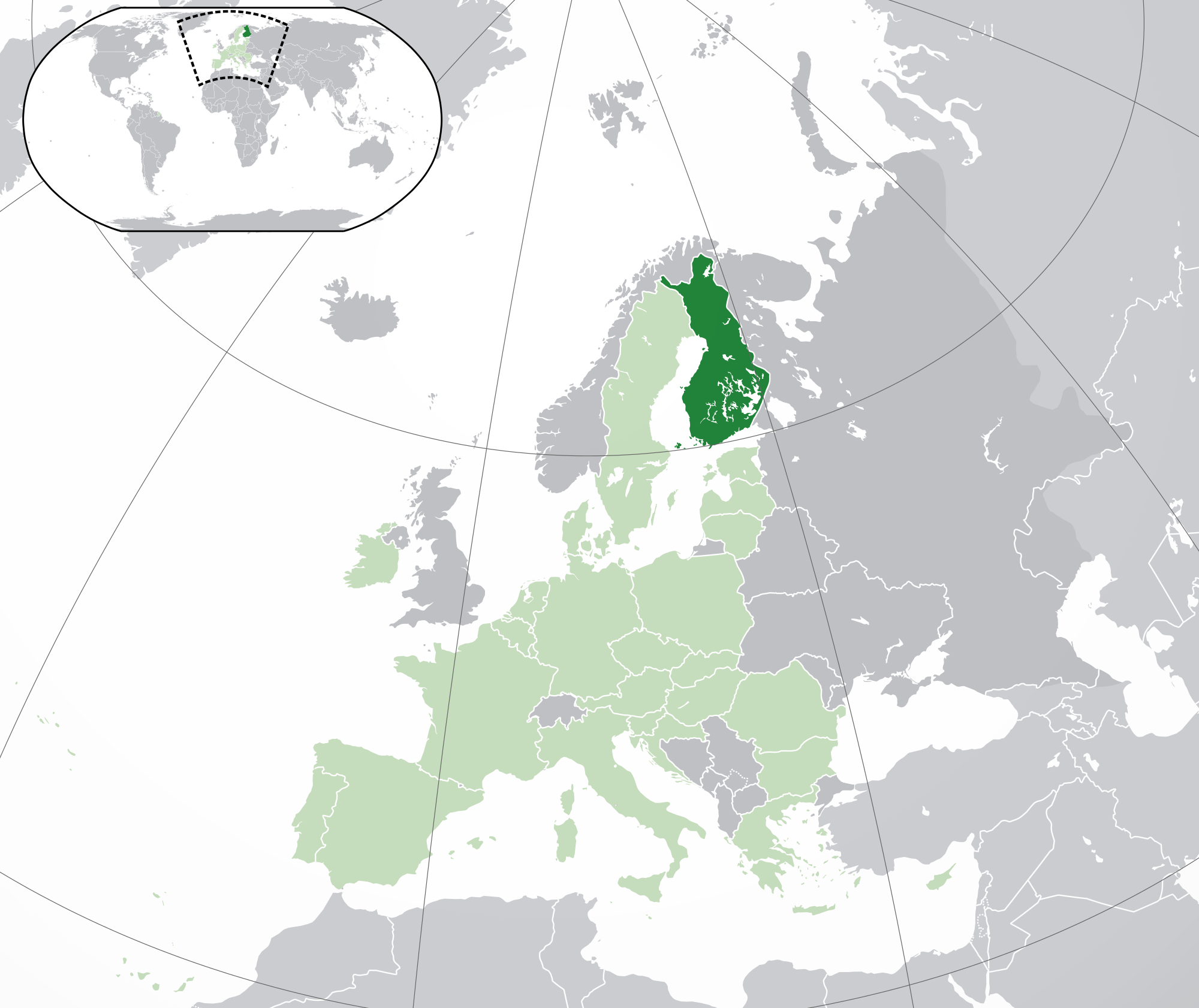
| जानकारी | Location map: Finland w/Åland (dark green) / European Union (light green) / Europe (dark grey); inspired by and consistent with general country locator maps by User:Vardion, et al. |
| दिनाङ्क | |
| स्रोत | अपन काम |
| लेखक | Quizimodo |
| दूसरे संस्करण |
|
.jpg)

|
File:EU-Finland.svg is a vector version of this file. It should be used in place of this PNG file when not inferior.
File:Location Finland EU Europe.png → File:EU-Finland.svg
For more information, see Help:SVG. |
 |
अधिकृत करब
| इस कार्य को इसके लेखक, I, Quizimodo द्वारा सार्वजनिक डोमेन में प्रकाशित किया गया है। यह पूरे विश्व में लागू होता है। कुछ देशों में यह कानूनी तौर पर नहीं हो सकता है; ऐसा हो तो: I, Quizimodo सभी को इस कार्य का इस्तेमाल किसी भी उद्देश्य से, बिना किसी बाधाओं के इन शर्तों के कानून द्वारा अनिवार्य किए तक करने की अनुमति देता/देती हैं। |
फाइल इतिहास
तखनका तिथि/ समए पर क्लिक करी जखनका फाइल देखबाक अछि
| तिथि/ समए | लघुचित्र | बीमसभ | प्रयोक्ता | समीक्षा | |
|---|---|---|---|---|---|
| अखनका | २३:५९, २८ जुलाई २०२० | | २,००० × १,६८२ (५५६ KB) | Maphobbyist | Update: UK left the EU |
| ००:२८, १९ फरबरी २०१४ |  | २,०५६ × १,८०० (३६८ KB) | Maphobbyist | Update: Croatia | |
| ०१:२४, २८ जुन २००९ |  | २,०५६ × १,८०० (३७८ KB) | Bosonic dressing | Finland w/Åland (dark green) / European Union (light green) / Europe (dark grey); inspired by and consistent with general country locator maps by User:Vardion, et al - updated - wider scope (w/Kosovo) (highlight EU in locator) | |
| ११:४७, १७ जुन २००९ |  | २,०५६ × १,८०० (३७६ KB) | Bosonic dressing | Finland w/Åland (dark green) / European Union (light green) / Europe (dark grey); inspired by and consistent with general country locator maps by User:Vardion, et al - updated - wider scope (w/Kosovo) (fix UK, Faeroes) | |
| १५:३२, १६ जुन २००९ |  | २,०५६ × १,८०० (३७६ KB) | Bosonic dressing | Finland w/Åland (dark green) / European Union (light green) / Europe (dark grey); inspired by and consistent with general country locator maps by User:Vardion, et al - updated - wider scope (w/Kosovo) (fix UK) | |
| १४:२८, १६ जुन २००९ |  | २,०५६ × १,८०० (३७७ KB) | Bosonic dressing | Finland w/Åland (dark green) / European Union (light green) / Europe (dark grey); inspired by and consistent with general country locator maps by User:Vardion, et al - updated - wider scope (w/Kosovo) | |
| १४:१३, १६ जुन २००९ |  | २,०५६ × १,८०० (३७८ KB) | Bosonic dressing | Finland w/Åland (dark green) / European Union (light green) / Europe (dark grey); inspired by and consistent with general country locator maps by User:Vardion, et al - updated - wider scope (w/Kosovo) | |
| १३:२२, १६ जुन २००९ |  | २,०५० × १,७०७ (१२२ KB) | Hayden120 | Restored prior version by user:Skies; there is no particular reason to deviate from the original standard. | |
| १२:३३, १६ जुन २००९ |  | २,०५६ × १,७३१ (३७८ KB) | Bosonic dressing | Finland w/Åland (dark green) / European Union (light green) / Europe (dark grey); inspired by and consistent with general country locator maps by User:Vardion, et al - updated (!) | |
| १२:३१, १६ जुन २००९ |  | २,०५६ × १,७३१ (३७९ KB) | Bosonic dressing | Finland w/Åland (dark green) / European Union (light green) / Europe (dark grey); inspired by and consistent with general country locator maps by User:Vardion, et al - updated (!) |
फाइलक उपयोग
ई पृष्ठमे ई फाइलक लिङ्क अछि:
विश्वव्यापी फाइल उपयोग
ई फाइल कऽ उपयोग निम्न दोसर विकिसभमे अछि:
- an.wikipedia.org कऽ उपयोग पर
- awa.wikipedia.org कऽ उपयोग पर
- bn.wikipedia.org कऽ उपयोग पर
- ca.wikipedia.org कऽ उपयोग पर
- dz.wikipedia.org कऽ उपयोग पर
- en.wikipedia.org कऽ उपयोग पर
- eo.wikipedia.org कऽ उपयोग पर
- eo.wiktionary.org कऽ उपयोग पर
- ext.wikipedia.org कऽ उपयोग पर
- gu.wikipedia.org कऽ उपयोग पर
- hi.wikipedia.org कऽ उपयोग पर
- incubator.wikimedia.org कऽ उपयोग पर
- ki.wikipedia.org कऽ उपयोग पर
- krc.wikipedia.org कऽ उपयोग पर
- lg.wikipedia.org कऽ उपयोग पर
- ml.wikipedia.org कऽ उपयोग पर
- pl.wikivoyage.org कऽ उपयोग पर
- pt.wikiquote.org कऽ उपयोग पर
- ro.wikipedia.org कऽ उपयोग पर
- ro.wikibooks.org कऽ उपयोग पर
- sat.wikipedia.org कऽ उपयोग पर
- tpi.wikipedia.org कऽ उपयोग पर
- zh-classical.wikipedia.org कऽ उपयोग पर