
फाइल:Map of Village Development Committees in Saptari District, Nepal.png

पूर्ण आनन्तर्य (३,५०८ × २,४७९ चित्राणु, फाइल आकार: ३१९ KB, माइम प्रकार: image/png)
| ई फाइल विकिमिडिया कमन्ससँ अछि। कमन्सकs विवरण पृष्ठसँ जानकारी एतए नीचाँ देखाएल गेल अछि। कमन्स एक फ्रि लाइसेन्स मिडिया फाइल परियोजना छि। अपने मद्ददतकs सकए छि। |
सङ्क्षेप
| जानकारी |
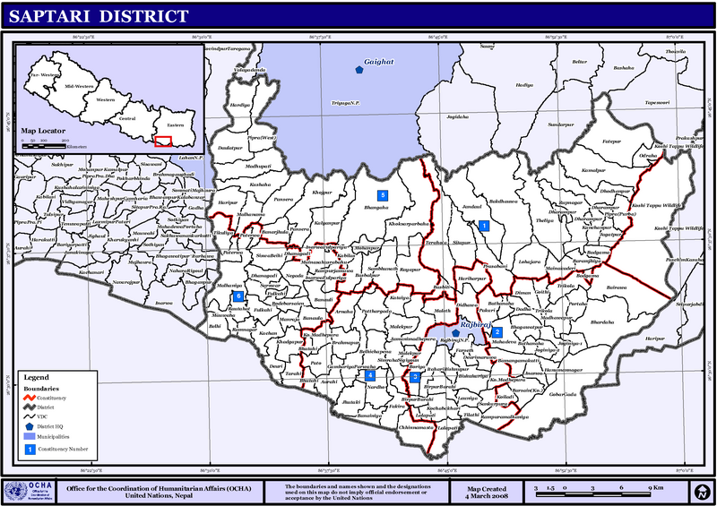
English: Map displaying Village Development Committees in Saptari District, Nepal |
| दिनाङ्क | |
| स्रोत | http://www.un.org.np/maps/district-maps/eastern/Saptari.pdf |
| लेखक | United Nations |
अधिकृत करब
| This image is a map derived from a United Nations map.
Unless stated otherwise, UN maps are to be considered in the public domain. This applies worldwide. UN maps are, in principle, open source material and you can use them in your work or for making your own map. UN requests however that you delete the UN name, logo and reference number upon any modification to the map. Content of your map will be your responsibility. You can state in your publication, if you wish, something like: based on UN map … (map name, map number, revision number and date). See: Geospatial Information Section. And: Geospatial, location data for a better world. |
 |
फाइल इतिहास
तखनका तिथि/ समए पर क्लिक करी जखनका फाइल देखबाक अछि
| तिथि/ समए | लघुचित्र | बीमसभ | प्रयोक्ता | समीक्षा | |
|---|---|---|---|---|---|
| अखनका | ००:४०, १६ नवम्बर २००८ | | ३,५०८ × २,४७९ (३१९ KB) | Sadalmelik | {{Information |Description={{en|1=Map displaying Village Development Committees in Saptari District, Nepal}} |Source=http://www.un.org.np/maps/district-maps/eastern/Saptari.pdf |Date=March 4, 2008 |Author=United Nations |Permission= |other_versions= |
फाइलक उपयोग
ई पृष्ठमे ई फाइलक लिङ्क अछि:
विश्वव्यापी फाइल उपयोग
ई फाइल कऽ उपयोग निम्न दोसर विकिसभमे अछि:
- da.wikipedia.org कऽ उपयोग पर
- de.wikipedia.org कऽ उपयोग पर
- en.wikipedia.org कऽ उपयोग पर
- fi.wikipedia.org कऽ उपयोग पर
- ms.wikipedia.org कऽ उपयोग पर
- ne.wikipedia.org कऽ उपयोग पर
- सप्तरी जिल्ला
- बोरिया
- डाढा
- दौलतपुर
- देउरी
- धनगढी(सप्तरी)
- फकिरा
- फुल्काही
- गाउँ विकास समिति (नेपाल)
- ढाँचा:सप्तरी जिल्लाका गाविसहरू
- जगतपुर(सप्तरी)
- अर्नाहा
- इटहरी विष्णुपुर
- इनर्वा फुलवरीया
- इनर्वा, सप्तरी
- ओद्राहा
- औरही
- कमलपुर
- कल्याणपुर
- कटैया
- काचन
- कविलासा
- कोइलाडी
- कोचाबखारी
- कुसाहा
- खडगपुर
- खोक्सरप्रवाहा
- खोजपुर
- गम्हरीयाप्रवाहा
- गोइठी
- दोधनपुर
- गोवरगाढा
- जण्डौल
- जमुनी मधेपुरा
- जोगिनियाँ-१
- जोगिनियाँ-२
- झुटकी
- टिकुलिया (सप्तरी)
- ठेलिया
- तिलाठी
- तेरहौता
- दिघवा
- देउरी मरुवा
- त्रिकोल
ई फाइलक विश्वव्यापी उपयोगक अधिक जानकारी देखी।