फाइल:Thar Desert satellite.jpg

ऐ पूर्वदृश्यक आकार: ४७१ × ५९९ चित्राणु. दोसर resolutions: १८९ × २४० चित्राणु | ५०० × ६३६ चित्राणु।
पूर्ण आनन्तर्य (५०० × ६३६ चित्राणु, फाइल आकार: ३२९ KB, माइम प्रकार: image/jpeg)
फाइल इतिहास
तखनका तिथि/ समए पर क्लिक करी जखनका फाइल देखबाक अछि
| तिथि/ समए | लघुचित्र | बीमसभ | प्रयोक्ता | समीक्षा | |
|---|---|---|---|---|---|
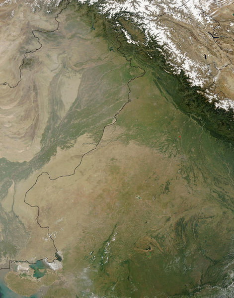
| अखनका | २०:१०, १७ सितम्बर २००५ |  | ५०० × ६३६ (३२९ KB) | Crux | Satellite Image of Thar Desert, India/Pakistan (border line in the middle) from en:, uploaded by en:User:Tom Radulovich |
फाइलक उपयोग
ई पृष्ठमे ई फाइलक लिङ्क अछि:
विश्वव्यापी फाइल उपयोग
ई फाइल कऽ उपयोग निम्न दोसर विकिसभमे अछि:
- ar.wikipedia.org कऽ उपयोग पर
- az.wikipedia.org कऽ उपयोग पर
- bg.wikipedia.org कऽ उपयोग पर
- bn.wikipedia.org कऽ उपयोग पर
- bs.wikipedia.org कऽ उपयोग पर
- ckb.wikipedia.org कऽ उपयोग पर
- de.wikipedia.org कऽ उपयोग पर
- en.wikipedia.org कऽ उपयोग पर
- eo.wikipedia.org कऽ उपयोग पर
- es.wikipedia.org कऽ उपयोग पर
- et.wikipedia.org कऽ उपयोग पर
- fa.wikipedia.org कऽ उपयोग पर
- fi.wikipedia.org कऽ उपयोग पर
- fr.wikipedia.org कऽ उपयोग पर
- he.wikipedia.org कऽ उपयोग पर
- hu.wikipedia.org कऽ उपयोग पर
- it.wikipedia.org कऽ उपयोग पर
- ja.wikipedia.org कऽ उपयोग पर
- ka.wikipedia.org कऽ उपयोग पर
- kk.wikipedia.org कऽ उपयोग पर
- kn.wikipedia.org कऽ उपयोग पर
- ko.wikipedia.org कऽ उपयोग पर
- ky.wikipedia.org कऽ उपयोग पर
- lfn.wikipedia.org कऽ उपयोग पर
- lt.wikipedia.org कऽ उपयोग पर
- mg.wikipedia.org कऽ उपयोग पर
- mk.wikipedia.org कऽ उपयोग पर
- ml.wikipedia.org कऽ उपयोग पर
- mr.wikipedia.org कऽ उपयोग पर
- ms.wikipedia.org कऽ उपयोग पर
- ne.wikipedia.org कऽ उपयोग पर
- nn.wikipedia.org कऽ उपयोग पर
- pa.wikipedia.org कऽ उपयोग पर
- pl.wikipedia.org कऽ उपयोग पर
- pnb.wikipedia.org कऽ उपयोग पर
- pt.wikipedia.org कऽ उपयोग पर
ई फाइलक विश्वव्यापी उपयोगक अधिक जानकारी देखी।


