मोड्युल:Location map/data/Asia/doc
दिखावट
| This is a documentation subpage for मोड्युल:Location map/data/Asia. It contains usage information, categories and other content that is not part of the original मोड्युल page. |
| name | एसिया | ||
|---|---|---|---|
| x | (52.8948) * (cos($1*0.01745329252) * sin(($2-95.0) * 0.01745329252)) * ( ((1+sin($1*0.01745329252) * sin(50.0*0.01745329252) + cos($1*0.01745329252) * cos(50.0*0.01745329252) * cos(($2-95.0)*0.01745329252)) * 0.5)^-0.5 )+50.0 | ||
| y | (100-59.381) - (59.381) * ( cos(50.0*0.01745329252) * sin($1*0.01745329252) - sin(50.0*0.01745329252) * cos($1*0.01745329252) * cos(($2-95.0)*0.01745329252) ) * ( ((1+sin($1*0.01745329252) * sin(50.0*0.01745329252) + cos($1*0.01745329252) * cos(50.0*0.01745329252) * cos(($2-95.0)*0.01745329252)) *0.5)^-0.5 ) | ||
| image | Asia_laea_location_map.svg
| ||

| |||
| image1 | Asia_laea_relief_location_map.jpg
| ||

| |||
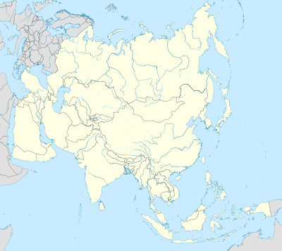
मोड्युल:Location map/data/Asia is a location map definition used to overlay markers and labels on an equirectangular projection map of एसिया. The markers are placed by latitude and longitude coordinates on the default map or a similar map image.
Usage
These definitions are used by the following templates when invoked with parameter "Asia":
{{Location map | Asia | ...}}{{Location map many | Asia | ...}}{{Location map+ | Asia | ...}}{{Location map~ | Asia | ...}}
Map definition
name = एसिया- Name used in the default map caption
image = Asia_laea_location_map.svg- The default map image, without "Image:" or "File:"
image1 = Asia_laea_relief_location_map.jpg- An alternative map image, usually a relief map, can be displayed via the relief or AlternativeMap parameters
x = (52.8948) * (cos($1*0.01745329252) * sin(($2-95.0) * 0.01745329252)) * ( ((1+sin($1*0.01745329252) * sin(50.0*0.01745329252) + cos($1*0.01745329252) * cos(50.0*0.01745329252) * cos(($2-95.0)*0.01745329252)) * 0.5)^-0.5 )+50.0- An expression to calculate a location on the map via its longitude; evaluates as 0 along the left edge and 100 along the right edge
y = (100-59.381) - (59.381) * ( cos(50.0*0.01745329252) * sin($1*0.01745329252) - sin(50.0*0.01745329252) * cos($1*0.01745329252) * cos(($2-95.0)*0.01745329252) ) * ( ((1+sin($1*0.01745329252) * sin(50.0*0.01745329252) + cos($1*0.01745329252) * cos(50.0*0.01745329252) * cos(($2-95.0)*0.01745329252)) *0.5)^-0.5 )- An expression to calculate a location on the map via its latitude; evaluates as 0 along the top edge and 100 along the bottom edge
Alternative map
The map defined as image1 (Asia_laea_relief_location_map.jpg) can be displayed by using the relief or AlternativeMap parameters in {{Location map}}, {{Location map many}} and {{Location map+}}. The use of these two parameters is shown in the examples below. Additional examples can be found at:
- Template:Location map#Relief parameter
- Template:Location map#AlternativeMap parameter
- Template:Location map+/relief
- Template:Location map+/AlternativeMap
See also
- Location map templates
- Template:Location map, to display one mark and label using latitude and longitude
- Template:Location map many, to display up to nine marks and labels
- Template:Location map+, to display an unlimited number of marks and labels
- Infobox templates incorporating (passing values to) the Location map template
List
- Template:Infobox airport — alternative map support: relief (via pushpin_relief) and AlternativeMap (via pushpin_image)
- Template:Infobox ancient site — alternative map support: relief
- Template:Infobox artwork
- Template:Infobox building — alternative map support: relief
- Template:Infobox casino
- Template:Infobox castrum — alternative map support: relief (via map_relief)
- Template:Infobox cave (via Infobox map) — alternative map support: relief
- Template:Infobox cemetery
- Template:Infobox civil conflict
- Template:Infobox climbing route (via Infobox map) — alternative map support: relief
- Template:Infobox church — alternative map support: relief
- Template:Infobox concentration camp
- Template:Infobox dam — alternative map support: relief
- Template:Infobox dava
- Template:Infobox forest (via Infobox map) — alternative map support: relief
- Template:Infobox glacier (via Infobox map) — alternative map support: relief (displays relief image unless map_relief=0)
- Template:Infobox golf facility — alternative map support: relief
- Template:Infobox historic site — alternative map support: relief (via map_relief)
- Template:Infobox hospital — alternative map support: relief
- Template:Infobox hut — alternative map support: relief
- Template:Infobox lighthouse — alternative map support: relief
- Template:Infobox map (used by other infoboxes) — alternative map support: relief
- Template:Infobox military conflict — alternative map support: relief (via map_relief)
- Template:Infobox military installation — alternative map support: relief (via map_relief)
- Template:Infobox monastery
- Template:Infobox mountain (via Infobox map) — alternative map support: relief (displays relief image unless map_relief=0)
- Template:Infobox mountain pass (via Infobox map) — alternative map support: relief (displays relief image unless map_relief=0)
- Template:Infobox mountain range (via Infobox map) — alternative map support: relief (displays relief image unless map_relief=0)
- Template:Infobox museum — alternative map support: relief (via map_relief)
- Template:Infobox oil field — alternative map support: relief
- Template:Infobox oil refinery — alternative map support: relief
- Template:Infobox operational plan
- Template:Infobox park (via Infobox map) — alternative map support: relief
- Template:Infobox power station — alternative map support: relief
- Template:Infobox protected area (via Infobox map) — alternative map support: relief
- Template:Infobox reactor
- Template:Infobox religious building — alternative map support: relief
- Template:Infobox restaurant
- Template:Infobox settlement — alternative map support: relief (via pushpin_relief) and AlternativeMap (via pushpin_image)
- Template:Infobox spring (via Infobox map) — alternative map support: relief
- Template:Infobox temple
- Template:Infobox terrestrial impact site
- Template:Infobox valley (via Infobox map) — alternative map support: relief
- Template:Infobox waterfall (via Infobox map) — alternative map support: relief
- Template:Infobox World Heritage Site — alternative map support: relief
